|
I have taken these photos on 15th September 2007 while travelling to a conference in Chamonix, France. I left home (Castano Primo, close to Milano) at about 11 am and drove leisurely to Courmayeur (Italy). I was there around 1:30 pm, drove the few kilometers to the village of La Palud and took a short cable-car ride to Pavillon du Mont Fréty (2173 m above sea level) where I took the first two pictures and had a lunch (polenta with sausage and a beer). On the way up I could see a pair of chamois (Rupicapra rupicapra, alpine mountain goats), totally unconcerned about the cable car passing above them, but I was not fast enough to photograph them. After the lunch and a siesta, I rode the cable back down and traversed the 11.6 km of the Mont Blanc tunnel to Chamonix (France) on the other side of the Mont Blanc massif. After registration at my hotel I have looked up the conference centre and found out that it was surrounded by a beautiful garden. At that point it was already late afternoon and there were signs of a weather change, but I have nevertheless still managed to capture a few beautiful views right from the garden. Next day it rained and the view was one of a uniform, gray cloud.
|
|
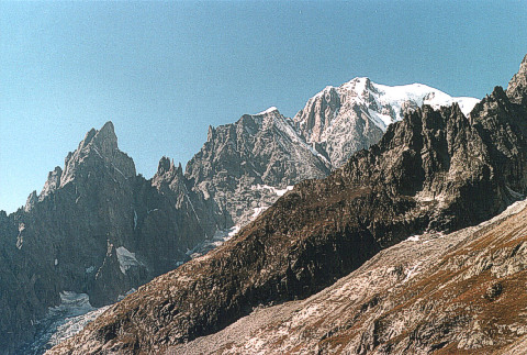
The south-east slopes facing Italy
Mont Blanc (4807 m) is the snow-covered roundish top on the right (the true top is not visible). The apparently highest peak is the Courmayeur Mont Blanc (Mont Blanc of Courmayeur, 4765 m). The kind of ledge with a tiny snow cap to its left is Aiguille Blanche (White Spire, 4108 m), making a pair with Aiguille Noir (Black Spire, 3773 m) looming on the left side of the picture. The group of lower sharp spires in between are the Dames Anglaises (English Ladies, 3601 m) - a name with a tragic meaning. At bottom left one has a peek at the front of the Courmayeur glacier which fills the valley hidden by the dark ridge.
Pavillon du Mont Fréty,
La Palud, Courmayeur, Italy.
|
|
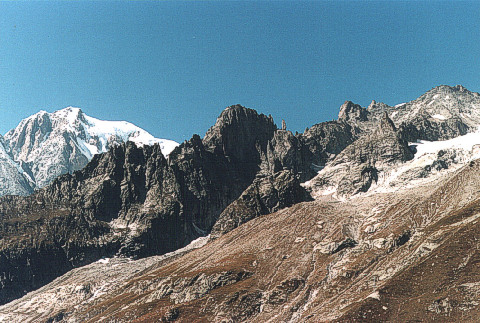
Same location, but taking in some of the awesome razor-sharp granite ridges and spires (aiguilles) characteristic of the whole Mont Blanc massif .
The dark peak in the center is Aiguille de la Brenva (De la Brenva Spire, 3278 m), while the thin, vertical stone beam jutting out from the saddle to its right is Pere Eternel (Eternal Father, 3224 m) or, more precisely, his admonishing finger. The hill on the right looks large only because of the perspective. Somewhere behind is the much taller Colle Toula (Toula Hill, 3444 m).
At Pavillon du Mont Fréty one can visit the Alpine Botanic Garden Saussurea - an interesting floral oasis maintained by the town of Courmayeur.
|
|
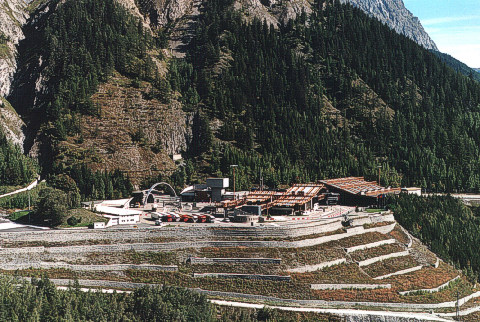
The Mont Blanc tunnel.
This is the Italian side entrance.
The buildings around the entrance used to be Italian and French police and customs headquarters - until the unification of Europe have made them nearly useless (police is still there, and a search for alternative uses is going on). Today, the most important of them are a few small toll-payment booths (32 euros one way, 40 euros return trip).
View from Val Veny, Italy.
|
|
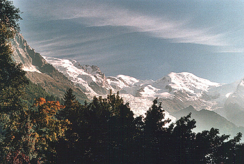
The north-west side facing France
Mont Blanc (White Mountain, 4807 m) is the roundish, snow-covered mountain to the right of the picture center.
Click here for a larger view of this shot
and a detailed description.
Chamonix, France.
|
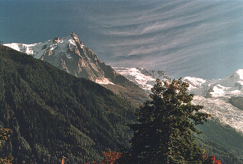
|
Aiguille du Midi (3842 m).
From Chamonix, you can reach the top of this spire in less than half hour by a comfortable cable car. There is an intermediate station for those who do not or should not risk exposing themselves to the 3842 meters altitude where scarcity of oxygen can already start playing foul tricks (most people feel dizzy and unstable as though they were drunk). This is the highest-altitude cable car in the world and the view from the top is something worth every one of the 37 euros it costs. For a bit more, you can ride on via Punta Helbronner, Rifugio Torino and Pavillon du Mont Fréty, down to La Palud on the Italian side (a one-day round trip is also an option).
Chamonix, France.
|
| |
|